
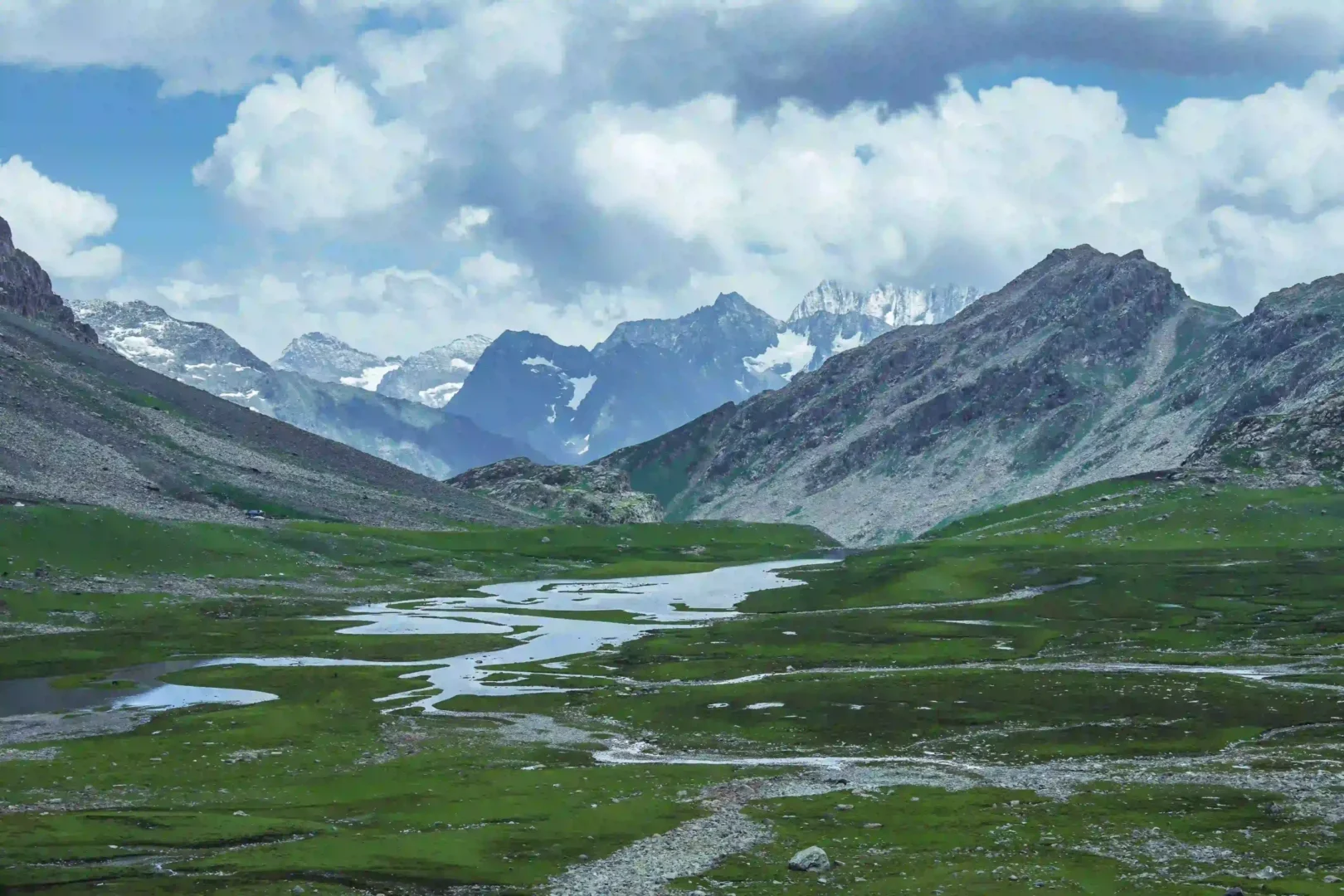
Margan Top isn’t a place most first-time Kashmir visitors have heard of, and that’s largely the point. Also called Margan Pass, it’s a high-altitude mountain crossing in South Kashmir that connects the main Kashmir Valley, via Kokernag and Daksum, to the remote Warwan Valley on the Kishtwar side. There’s no town here, no market, nothing built for tourists — just a road climbing through pine forest into alpine meadow and then bare, wind-scoured ridge, with views that most people who’ve done the standard Gulmarg-Pahalgam circuit never see. This guide covers how to actually get there, what the road is like, when it’s open, and what a day at Margan Top realistically looks like.
Where Is Margan Top and How High Is It?
It sits on the border of Anantnag district in the Kashmir Valley and Kishtwar district in the Jammu division, roughly 35–45 km from Kokernag along the Kokernag–Daksum–Sinthan road. Elevation figures vary a little depending on the source, but it sits somewhere around 11,650–12,100 feet (3,550–3,700 m) — high enough that weather changes fast and the air is noticeably thin if you’re not acclimatized.
A quick fact sheet before you plan around it:
- District: Anantnag (Kashmir side) / Kishtwar (Jammu side)
- Elevation: Approximately 11,650–12,100 ft (3,550–3,700 m)
- Distance from Kokernag: Roughly 35–45 km
- Distance from Anantnag town: Approximately 70 km
- Distance from Srinagar: Roughly 115–125 km (about 3.5–4 hours by road)
- Route: Srinagar/Anantnag → Kokernag → Daksum → Margan Top
- Nearby landmark: Sinthan Top, a short distance further along the same road toward Kishtwar
- Permit required: No — unlike border-adjacent destinations such as Keran or Gurez, Margan Top doesn’t require a special permit for domestic travelers
How to Reach Margan Top
There are two practical starting points, and which one makes sense depends on where the rest of your Kashmir trip is based.
From Srinagar: The route runs Srinagar → Anantnag → Kokernag → Daksum → Margan Top, covering roughly 115–125 km and taking around 3.5 to 4 hours one way, depending on road conditions and how many stops you make at Kokernag’s gardens or Daksum’s forest along the way.
From Pahalgam: If you’re already based in Pahalgam, a lesser-known local route connects through Anantnag and Kokernag to reach the same Daksum–Margan Top–Sinthan Top stretch, making it a realistic day trip if you don’t want to backtrack all the way to Srinagar first.
Anantnag to Margan Top: Distance, Route & Travel Time
| Route Segment | Distance | Estimated Time |
| Anantnag to Margan Top | Approx. 70 km | ~2.5 to 3 hours |
| Kokernag to Margan Top | 35 – 45 km | ~1.5 to 2 hours |
| Srinagar to Margan Top | 115 – 125 km | ~3.5 to 4 hours |
Whichever direction you’re coming from, the last stretch past Daksum narrows considerably, with switchbacks and patches of loose gravel as the elevation climbs. A local taxi, a 4×4, or a sturdy SUV is strongly advisable — small sedans can technically make it in good weather, but drivers who know the road are worth the extra cost, especially since conditions can change with little warning at this altitude.
Margan Top Road Condition and Which Vehicle to Take
The road to Margan Top is part of the experience, but it is not a route to take casually. The drive is relatively straightforward until the Kokernag and Daksum side, after which the road becomes narrower and more demanding as it climbs towards higher altitude.
Conditions can vary significantly depending on recent rain, snowmelt and road maintenance. Some stretches may have loose gravel, uneven surfaces and rough patches, particularly closer to the higher sections.
Which vehicle is best?
A sturdy SUV is the most comfortable option for reaching Margan Top. A 4×4 can be useful when road conditions are poor, although it may not always be necessary during good weather.
Small sedans can sometimes make the journey when conditions are favourable, but they are not the ideal choice for this route. If you’re unfamiliar with mountain roads, travelling with a local driver who knows the current route conditions is strongly recommended.
Before leaving, especially during early or late season, check the latest road and weather conditions. Mountain weather can change quickly, and a route that looks manageable in the morning can become more difficult later in the day.
Best Time to Visit Margan Top
June to September is the only realistic window. Snow blocks the higher stretches of road for the rest of the year, and even within this window, conditions can shift fast — a clear morning at Daksum doesn’t guarantee a clear afternoon at the top. Late June through August tends to have the most reliably motorable road and the fullest alpine meadows in bloom; by September, the crowds (such as they are here) thin out further and the light turns noticeably sharper for photography.
You can also check our Gooogle Profile here. Link
Outside this window, don’t plan around Margan Top at all — the pass closes, and there’s no realistic way through.
Things to Do at Margan Top
There’s no checklist of sights here in the way Pahalgam or Gulmarg have one. What fills the time is simpler:
- Photography: Snow patches against green meadow, the Warwan-side ranges, and wildflowers through July are the main draw, and the light here is genuinely different from anywhere else in the valley.
- Trekking access: It’s a real trailhead here, not just a viewpoint. A multi-day route toward Sinthan Top passes several high-altitude lakes over 3–4 days, and a longer route toward Botakote near Pahalgam runs 4–5 days through Langnai Valley past four more lakes. Both are serious treks requiring proper planning, not casual day hikes.
- Stargazing: With no permanent settlement and essentially zero light pollution, clear nights here are genuinely dark in a way few places in Kashmir still are.
- A day trip from Daksum or Kokernag: Not everyone needs to trek — plenty of visitors simply drive up, spend an hour or two at the top, and head back down the same day.
What to Actually Expect — No Facilities
This is worth saying plainly, because it’s easy to miss on a quick search: there is nothing at Margan Top itself. No shops, no dhabas, no fuel, no mobile signal to rely on. Carry all the food, water, and warm layers you’ll need before you leave Daksum or Kokernag, and don’t count on connectivity to call ahead or check the weather once you’re on the climb. Temperatures drop fast even in July, so pack a proper layer regardless of how warm it is when you set out.
The nearest places to stay are in Kokernag (roughly 35–45 km away, with government tourist bungalows and private guesthouses) and Daksum (closer, with more basic forest huts and homestays) — both realistic bases if you’d rather not attempt the climb and a long return drive in a single day.
What to Carry When Visiting Margan Top
Since there are no reliable facilities at Margan Top itself, it is important to prepare before leaving Kokernag or Daksum.
Carry:
- Drinking water
- Snacks or packed food
- A warm jacket or additional layer, even during summer
- Power bank
- Basic medicines
- Sunglasses and sunscreen
- Comfortable shoes suitable for uneven ground
- Any important documents you may need during your journey
Mobile connectivity should not be relied upon at higher stretches, so it is also a good idea to download offline maps and save important travel information before starting the climb.
The key is simple: once you leave the more populated areas behind, assume you will need to manage with whatever you have brought with you.
Margan Top or Sinthan Top?
The two are close enough on the same road that people often ask which one to prioritize. Sinthan Top sits a little further along toward Kishtwar and is somewhat better known and marginally more developed in terms of road access, while Margan Top is quieter and slightly less visited. If you’ve got the time, doing both in one long day from Daksum is realistic — they share the same access road for most of the way.
| Feature | Margan Top | Sinthan Top |
| Vibe & Crowd | Wild, quiet, and completely offbeat | Slightly more developed and visited |
| Connectivity/Facilities | Zero facilities, no mobile signal | Minimal facilities, roadside tea stalls |
| Best For | Raw wilderness, Warwan valley link, stargazing | 360-degree panoramic highway views |
| Accessibility | Requires careful road assessment; 4×4 or SUV ideal | Accessible via the main Kishtwar highway road |
If you’ve got the time, doing both in one long day from Daksum is realistic — they share the same access road for most of the way.
Combine Margan Top with the Rest of South Kashmir
It sits in the same general Kokernag–Daksum corridor as a few other places worth folding into the same trip. If you’re basing yourself in Pahalgam or exploring Aru Valley, a detour here fits naturally into a longer South Kashmir loop rather than requiring a separate trip from Srinagar. Aharbal Waterfall, also in South Kashmir, pairs well on a broader offbeat itinerary too.
If the multi-day treks toward Sinthan Top or Botakote interest you, our guide to unexplored alpine lake trekking routes in Kashmir covers the planning side of routes like these in more depth. And if avoiding the usual tourist crush is the whole point for you, see our piece on how to avoid tourist crowds in Kashmir’s main hubs — this is about as far from that crush as South Kashmir gets.
Why Visit Margan Top with a Local Operator
It isn’t a destination we’d send anyone to blind. The road past Daksum needs a driver who actually knows its current condition — not last season’s, since washouts and landslide damage are common at this altitude, and a route that was fine in July can be genuinely rough by September. It’s also not somewhere you want to be stuck without a plan if the weather turns while you’re at the top.
We’re based in Srinagar and fold Margan Top into fully customized Kashmir holiday packages for travelers who want this specific detour alongside the rest of their trip, whether that’s a day trip from Pahalgam or a dedicated South Kashmir loop. Our piece on what actually makes a difference in a local tour operator explains why route-specific, current knowledge matters more here than it does on the standard circuit.
Plan Your Offbeat Margan Top & Warwan Circuit
Cross into Kashmir’s wildest mountain pass with expert 4×4 chauffeurs, vetted stays in Daksum and Kokernag, and customized day itineraries starting from Srinagar or Pahalgam.
Frequently Asked Questions
How do I reach Margan Top from Srinagar?
The route runs Srinagar → Anantnag → Kokernag → Daksum → Margan Top, covering roughly 115–125 km and taking about 3.5 to 4 hours by road, depending on conditions.
What is the height of Margan Top?
It sits at approximately 11,650–12,100 feet (3,550–3,700 m), depending on the source — high enough that weather and temperature can shift quickly.
What is the best time to visit Margan Top?
June to September, once the higher stretches of road have cleared of snow and become motorable. Outside this window, the pass is effectively closed.
Do I need a permit to visit Margan Top?
No — it doesn’t require the kind of special permit needed for border-adjacent destinations like Keran or Gurez Valley. Standard identification is sufficient.
Is Margan Top the same as Sinthan Top?
No, though they’re often mentioned together. Both are mountain passes on the same Kokernag–Daksum road toward Kishtwar, a short distance apart — Sinthan Top is slightly further along and somewhat better known.
Are there hotels or shops at Margan Top?
No — there are no facilities at the top itself. The nearest accommodation is in Kokernag and Daksum, both roughly 35–45 km and closer respectively.
Want to add Margan Top to your South Kashmir itinerary? Get in touch and we’ll plan the route, the timing, and the stay around it — or browse our full range of Kashmir tour packages to see how it fits into a longer trip.